Field works. Example 11.
Imaging karst hazard of the area.
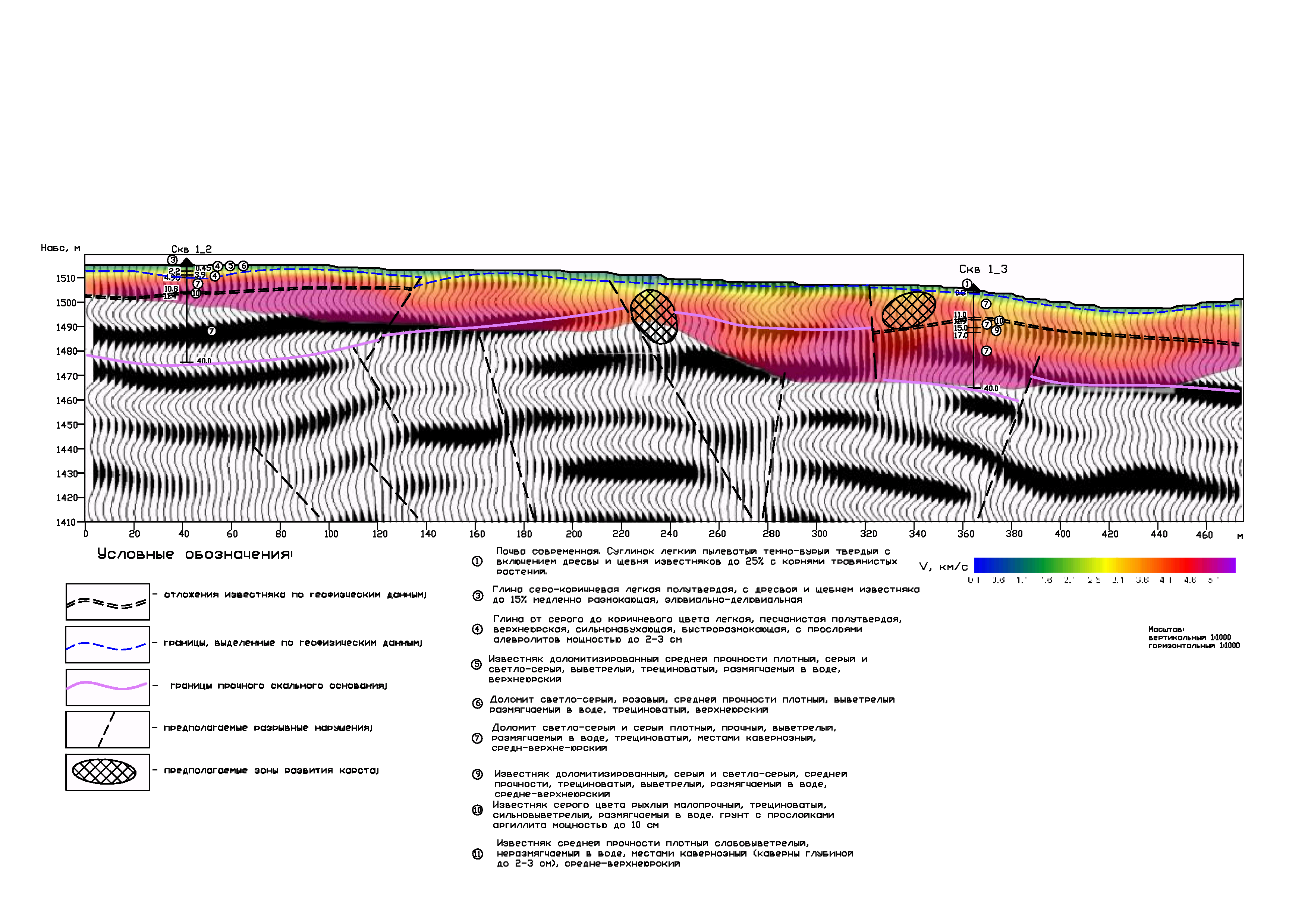
Exploration target is situated in the North Caucasian Federal District (Krasnodar territory) and Republic of Adygeya. Engineering geophysical survey acquired to evaluate the karst hazard of the area. Integrated seismic survey (Seismic refraction method and CDP method) were conducted to differentiate geological section by velocity. Interpretation result was the model to a depth of 40 m. The upper layer is presented the rocks with velocity 1.3-2.3 km/sec. Velocity values of second layer increase to 2.7-3.3 km/sec. Average thickness is 2 m. The third layer has high velocity values from 3.7 to 4.5 km/sec. In the base of the model from point 10 to point 200 and from point 280 to point 475 are the high velocity zones (4.9-5.3 km/sec).
Inversion result of refraction seismotomography is the geoseismic model to a depth of 40 m. On a model we can allocate the possible karst areas and tectonic faults. Using CDP allows to describe the structure of geological model to a depth of 100 m and more.
Seismic data were processed with the use of ZondST2D.
