Field works. Example 2.
GPR survey area for construction
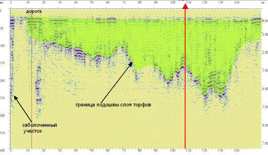
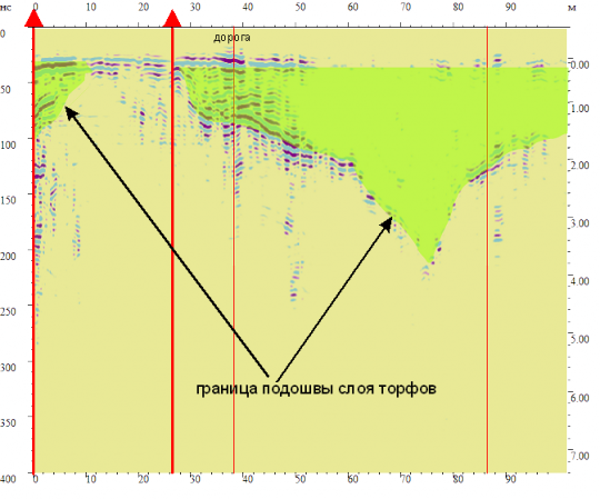
The main aim of GPR surveying is to determine the peat deposits on the planned site and the road line. To solve this problem was carried out a GPR profiling.
Radargrams of profile under the geological structures which confirmed results of drilling were interpreted. Stratum and wave pattern characteristics were detected.
Peat locations were detected by radargrams. Strong decline signal amplitude shows the availability of clay loam. We can only detect a top layer.

