ZondRes2dp
ZondRes2dp software is disigned for two-dimensional interpretation of resistivity and induced polarization data in land and cross-borehole variants. The program allows solve a 2.5-dimensional forward and inversion problem. The term “2.5” means that the geological section is two-dimensional and the field of the source is three-dimensional. The software allows working with standart profiling and electrical tomography data.
Electrical tomography is a whole technique including both the method of field observations and technology of processing and field data interpretation. Its feature is multiple reusing as a source and receiver just the same electrodes position, fixed on a profile line.
Such approach allows from one hand to work with a modern high-performance instruments, and on the other hand, to apply effective algorithms of modeling and inversion. For interpretation of electrical tomography data is used two- and three-dimensional models. It significantly extends the range of electric prospecting solved problems due to sections investigating that are considerably different from «classic» horizontal-stratified.
Resolution and thus interpretation quality of electrical tomography is closely connected with the number and density of measurements on one site. Their number usually reaches first thousand that is why the question on field measurements efficiency has basic importance and in many respects defines possibility of practical use of this method. Special apparatus with programmed automatic switching of electrodes is applied for reaching of maximum effectiveness of field works.
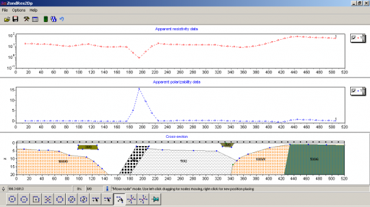
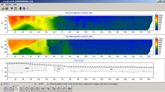
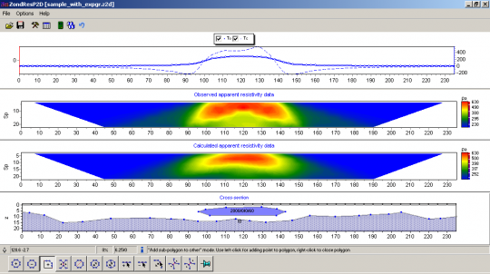
Unlike ZondRes2d, this program uses a polygonal variant of geoelectric section construction that gives more structural approach to data interpretation. At this scheme two-dimensional section cosist of series of bodies with arbitrary geometries and specified resistivity and polarization. Due to convenient and intuitively clear interface ZondRes2dp allows to quickly creating any level of complexity models.
ZondRes2dp represents ready solution for interpretation of resistivity and induced polarization methods data and solves wide range of problems from mathematical modeling to processing and field data interpretation. Convenient interface and ample opportunities of data presentation allow solve set geological problem with maximum effectiveness.
ZondRes2dp is essential tool for interpretation of the electro profiling data, complex interpretation, and also in the course of students studying and for geophysics beginners. The software is especially useful for electro profiling data when number of data is not enough for ERT inversion.
ZondRes2dp uses simple and clear data format that allows combine easily various systems of observation, including different variants of the topography setting up and other additional information. Well-known data formats are also supported (Res2Dinv, ABEM, Sens2dInv etc.).
The program works with any (applied in electric prospecting) types of electrodes array (two, three and four – electrodes) or their combinations. There is possibility of all three coordinates (XYZ) setting up for each of electrodes.
Additional module allows expand the program by modeling mode of gravimagnetic data. Thus, to each body of the section two additional parameters are added – density and magnetic susceptibility. Joint interpretation of those methods allows solve successfully many geological tasks.
ZondRes2dp has wide set of tools for mathematical modeling of DC and induced polarization fields. In the program also there is a possibility to import and display results of measurements by other methods and cross-borehole data that improve interpretation results. Besides this, algorithms of polygon parameters inversion are included in the program. They allow correct automatically parameters of objects.
Version 27 / 8 / 2017 | Software: download


