ZondMAG2D
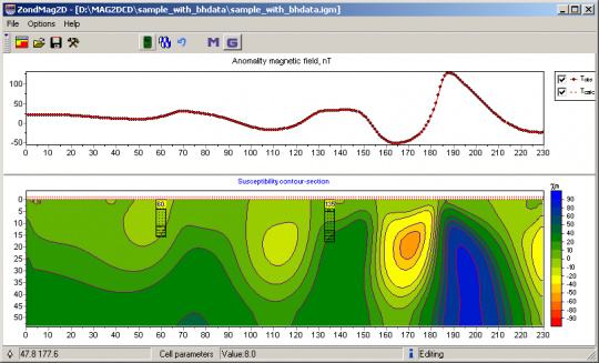
ZondMAG2d program is desined for two-dimensional interpretation of gravity and magnetic data by (land and aero variants).
ZondMAG2d represents ready solution for gravity and magnetic methods, and solves wide range of problems from mathematical modeling to field data processing and interpretation. Convenient interface and variety of data visualization features allow to solve wide range of geological problems with maximum effectiveness.
ZondMAG2d uses simple and clear data format which allows easily combining various systems of observation, including different variants of the topography setting up and other additional information.
Important stage which prevents field measurement is mathematical modeling of petrophysical structure of work site. Modeling gives a chance to make a choice of optimum parameters of the observation system for decision of formulated geological problem.
As the general task of the program is inversion of density and magnetic susceptibility, some variants of inverse problem decision are realized in ZondMAG2d, basic of them are: smoothing inversion – to get smooth model and focusing — to get piece-smoothed model of petrophysical parameters with depth.
While program was designed special consideration given to a priori data accounting. Because of equivalence of inverse geophysical problems, quality of the obtained results strongly depends on the amount of a priori data used. In ZondMAG2d there is possibility of weights setting for measurements, fixing and limits making of changing features of different cells, using of a priori model as reference in inversion. There is also possibility to import and display results of measurements by other methods and cross-boreholes data that improved quality of results.
Version 27 / 8 / 2017 | Software: download
